Geospatial Services Built for
Real-World Decisions
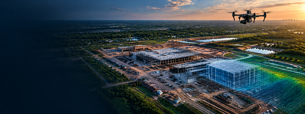
High-accuracy aerial mapping, photogrammetry, 3D modeling, and inspection solutions that transform field data into actionable geospatial intelligence.
Geospatial Solutions for Every Stage of Your Project
Terravionix delivers accurate, repeatable geospatial data and visual intelligence to help clients document conditions, monitor progress, inspect assets, and make informed decisions throughout the project lifecycle.
Aerial Mapping & Photogrammetry
Capture high-resolution aerial imagery and transform it into accurate orthomosaics, elevation models, point clouds, and measurable site data.
Construction Progress Monitoring
Track site development over time with consistent aerial documentation, progress imagery, and measurable data for clearer project oversight.
3D Modeling & Digital Twins
Create detailed 3D representations of sites and structures for visualization, documentation, measurement, and ongoing asset management.
Asset Documentation & Inspection
Create detailed visual records of facilities and infrastructure to support condition assessment, maintenance planning, and asset management.
Geospatial Data & Deliverables
Turn field data into actionable orthomosaics, elevation models, point clouds, and other project-ready geospatial products.
Aerial Mapping & Photogrammetry
Terravionix captures high-resolution aerial imagery and converts it into accurate, measurable geospatial products that provide a clear view of site conditions. Our photogrammetry workflows support planning, documentation, measurement, and analysis across construction, infrastructure, and commercial projects.
- High-resolution orthomosaics
- Digital Surface Models (DSM)
- Digital Terrain Models (DTM)
- 3D models and textured meshes
- Point Clouds (LAZ/COPC)
- Measurable site imagery and mapping products
Ideal For
- Construction and site development
- Commercial and industrial properties
- Infrastructure projects
- Land development and planning
- Existing-condition documentation
What You Receive
Deliverables are tailored to project requirements and may include georeferenced orthomosaics, elevation models, 3D models, point clouds, and other project-specific geospatial data products.
Construction Progress Monitoring
Terravionix provides consistent aerial documentation throughout the construction lifecycle, giving project teams a clear visual record of site conditions and progress over time. Repeatable flights and geospatial data help support project oversight, stakeholder communication, documentation, and comparison of changing site conditions.
- Repeatable aerial progress imagery
- High-resolution site orthomosaics
- Visual comparison of site conditions over time
- Documentation of construction milestones
- Measurable site data for project review
- Organized historical project records
Ideal For
- General contractors and construction managers
- Owners and developers
- Commercial and industrial construction
- Infrastructure projects
- Long-term or multi-phase developments
What You Receive
Deliverables are tailored to the project schedule and may include recurring aerial imagery, georeferenced orthomosaics, progress comparisons, milestone documentation, and organized visual records that provide a consistent view of site development over time.
3D Modeling & Digital Twins
Terravionix transforms aerial imagery and geospatial data into detailed 3D representations of sites, structures, and terrain. These models provide an intuitive way to visualize existing conditions, take measurements, document assets, and create a digital foundation that can support planning, analysis, and ongoing project or facility management.
- Detailed 3D site and structure models
- Textured 3D meshes
- Dense point clouds
- Terrain and surface visualization
- Measurements and spatial analysis
- Digital records for future comparison and asset documentation
Ideal For
- Construction and development projects
- Commercial and industrial facilities
- Existing-condition documentation
- Facility and asset management
- Planning, design, and stakeholder visualization
What You Receive
Deliverables are tailored to project requirements and may include textured 3D models, dense point clouds, digital surface representations, and other project-specific geospatial datasets suitable for visualization, measurement, documentation, and future comparison.
Asset Documentation & Inspection
Terravionix provides detailed aerial visual documentation of facilities, structures, and infrastructure to support condition assessment, maintenance planning, and asset management. High-resolution imagery creates a clear, organized record of asset conditions while helping teams review difficult-to-access areas efficiently and safely.
- High-resolution asset imagery
- Detailed visual condition documentation
- Hard-to-access area observation
- Infrastructure and facility documentation
- Repeatable imagery for condition comparison
- Visual records to support maintenance planning
Ideal For
- Commercial and industrial facilities
- Utilities and infrastructure
- Construction and development sites
- Facility and property managers
- Owners requiring recurring asset documentation
What You Receive
Deliverables are tailored to the asset and inspection objectives and may include high-resolution aerial imagery, organized visual documentation, annotated observations, and repeatable image sets that support condition assessment, maintenance planning, and future comparison.
Geospatial Data & Deliverables
Terravionix transforms collected field data into practical geospatial products that help clients visualize, measure, document, and analyze real-world conditions. Deliverables are prepared according to project requirements and can support construction, engineering, planning, asset management, and integration with existing GIS or CAD workflows.
- Georeferenced orthomosaics
- Digital Surface Models (DSM)
- Digital Terrain Models (DTM)
- Dense point clouds (LAZ/COPC)
- 3D models and textured meshes
- Project-specific GIS and CAD-ready data products
Ideal For
- Construction and engineering teams
- Surveying and geospatial professionals
- Architects and planners
- Facility and asset managers
- Clients requiring GIS or CAD-compatible project data
What You Receive
Deliverables are tailored to project requirements and may include georeferenced orthomosaics, elevation models, point clouds, 3D models, and other project-specific geospatial datasets provided in appropriate formats for visualization, analysis, documentation, or integration into existing workflows.
Ready to Put Your Site Data to Work?
Tell us about your project, site, or inspection needs. Terravionix can help determine the right data collection approach and deliverables for your objectives.